-
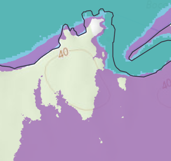
Coastal Vulnerability Analysis
Overview A statewide coastal vulnerability and prioritization analysis for Washington State, examining how sea level rise, tides, and coastal storm scenarios impact transportation infrastructure. Status Ongoing. A more detailed write-up will be added in the future. Once results are published to the general public, more descriptive maps will be added. Role Lead spatial scientist supporting…
-
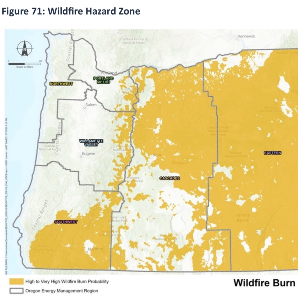
ODOE – Climate Resilience Exposure Analysis
I conducted geospatial analysis focused on identifying the exposure of the liquid fuels network across the state of Oregon to ten identified climate variables. The network included pipelines, transportation routes, fueling stations, and many more critical components. The geo processing script I developed on this project is going to be very useful for adaptation to…
-
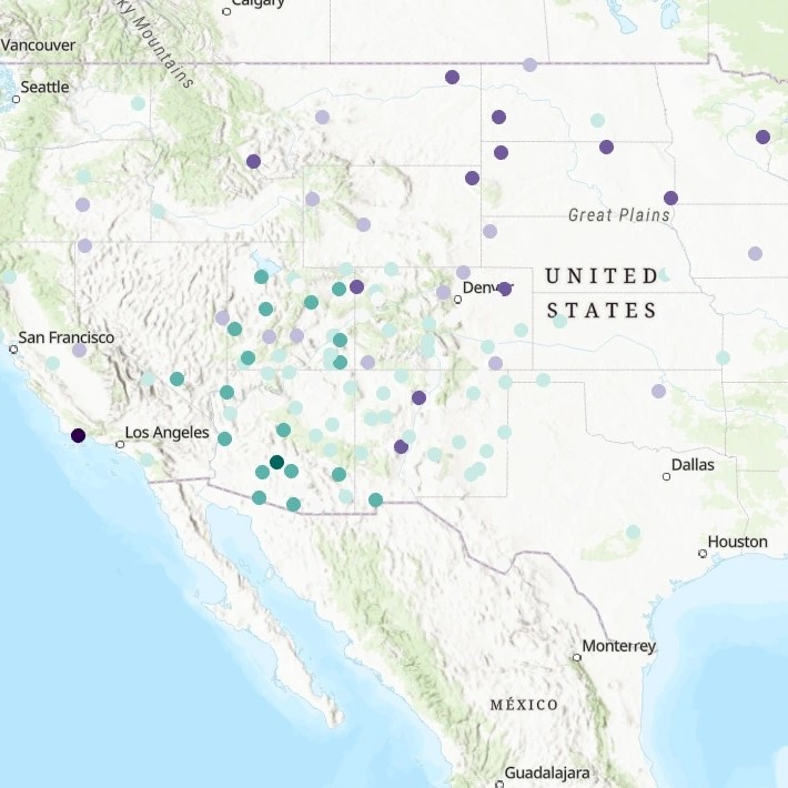
Linear Regression Analysis
For this analysis, I was not looking to create a shareable output but was studying the data provided from an ESRI Academy “Lab”. The course had us take a look at weather station data, choose variables suitable for running a regression analysis for predicting temperature and analyze the results. The data was first looked at…
-
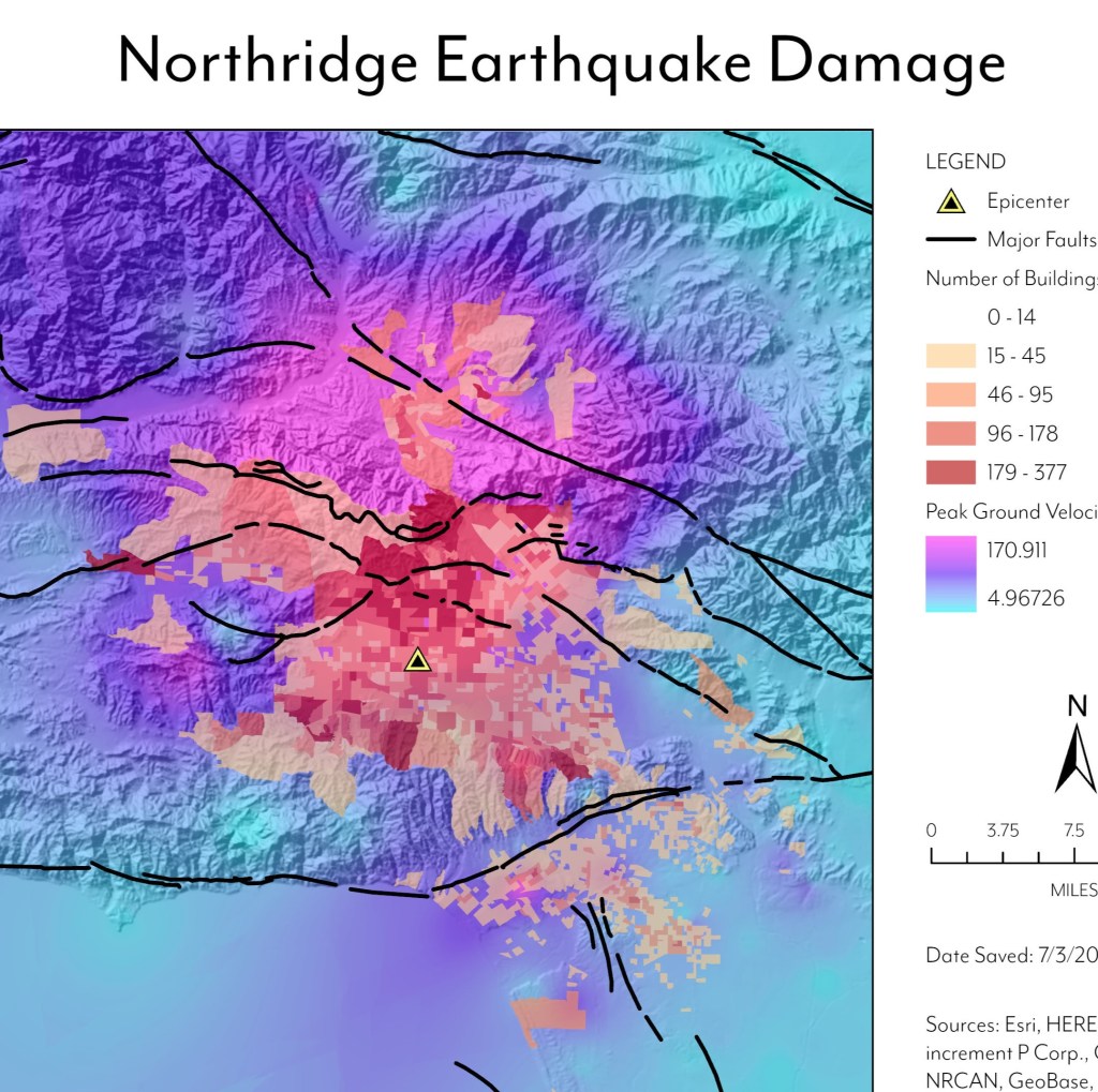
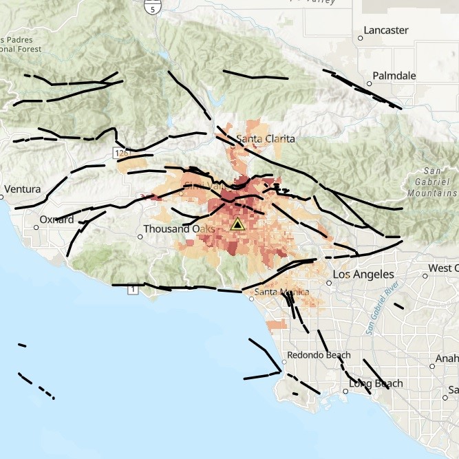
Earthquake Analysis
This soon to be retired ArcGIS Pro course on ESRI Academy was the longest and one of the best ESRI Academy courses I’ve taken so far. After adding the data to the map, we: To create the map layout shown here I went above and beyond the course information to clean up the symbology to…
-
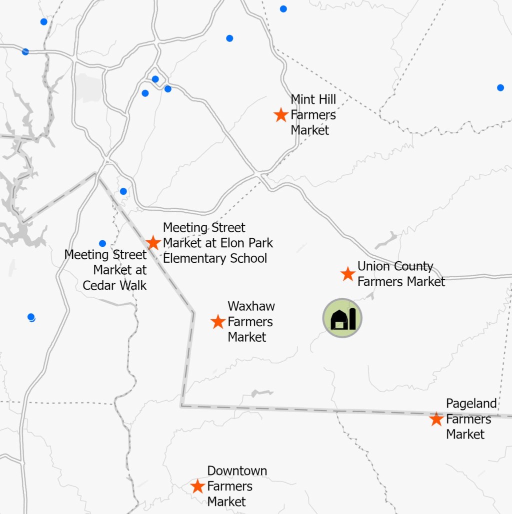
Distance Analysis
For this ESRI Academy analysis, I took existing farmer’s market locations and selected only those within a 20 mile radius of the farm. I went a few steps further by separating the selected layer out so they could have a different symbology than farmer’s markets outside of 20 miles. I also constrained the labels so…
-
Reservoir Suitability Analysis
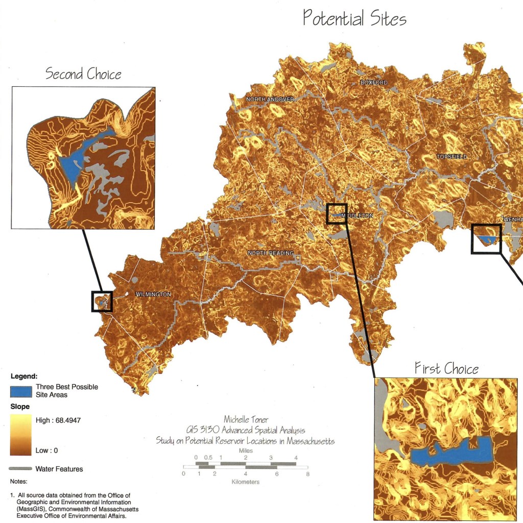
This project was completed as part of my Masters Degree in Informatics with a GIS concentration at Northeastern University. As a local to the Quabbin Reservoir region in Massachusetts which eliminated a number of towns, I though it would be interesting to conduct a study using more advanced GIS technology to determine the suitability for…
-

ArcObjects Custom 3D GIS
This was a unique use of GIS to create a custom facility data viewer accessible to the clients. While many of the features of this GIS are now considered standard, such as being able to view a site photograph when clicking on a location, this entire GIS was pushing the boundaries of the then available…
-
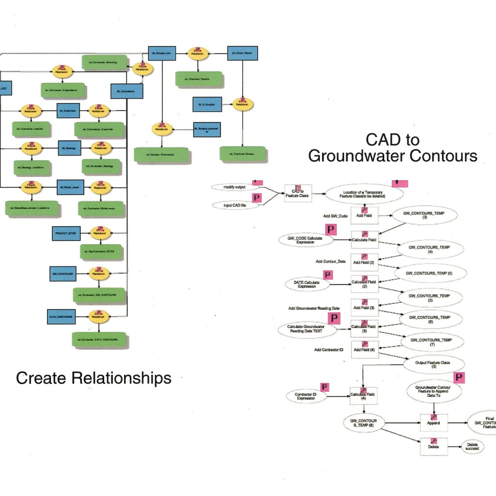
Model Script for Groundwater Contours
This is a graphic of a script I created using Model Builder in ArcGIS to create a groundwater contour feature class from imported CAD data. Assuming data management standards were adhered to with the CAD drawing, the script would take all the groundwater contours and create a feature class from them for optimum useability within…
-
ArcGIS Online Data Viewer
This is a link to training data I symbolized and uploaded to ArcGIS online. It includes several layers that supplement the work done on the Northridge Earthquake data. I have kept this hosted on the ESRI website instead of embedding it here to minimize storage requirements on my website. Clicking on the image will open…
-
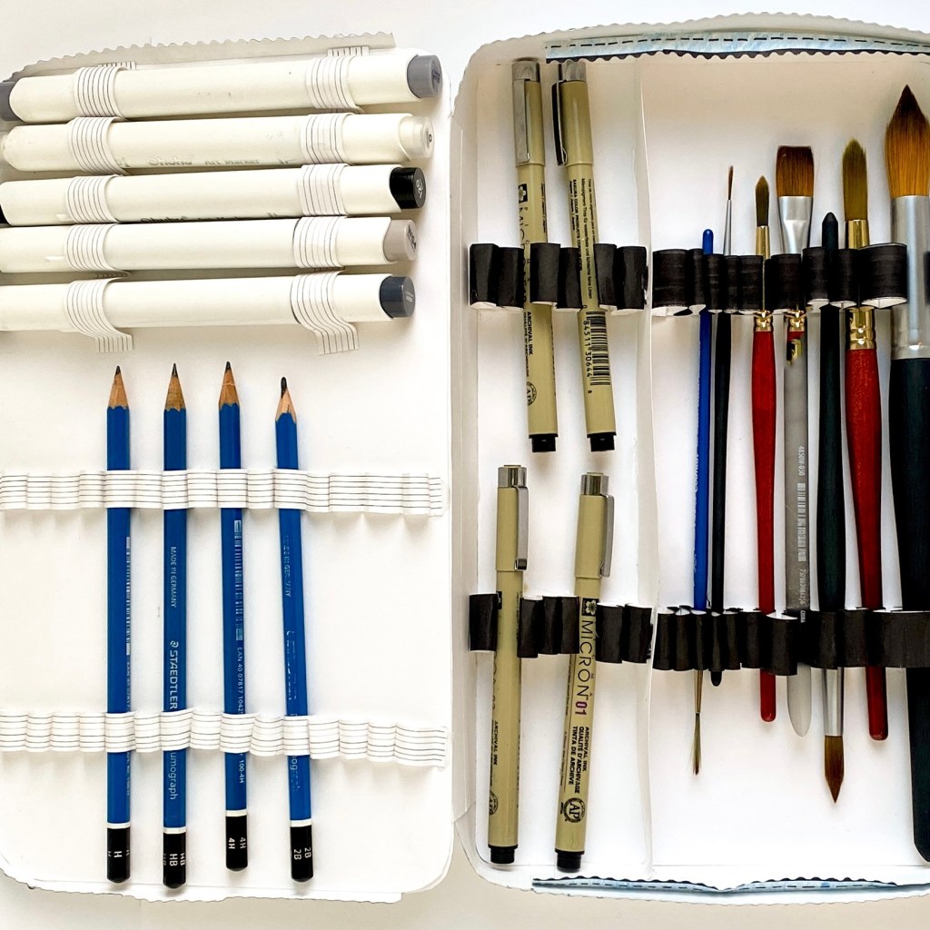
Modeling from Artist Rendering
For this project I designed a mixed media storage container based on the storage and travel needs of a variety of mixed media items. The initial designs were drafted to scale as an artist rendering by hand in pencil. These designs were then photographed and edited in Adobe Photoshop to create a display graphic for…
-
Subscribe
Subscribed
Already have a WordPress.com account? Log in now.
