Overview
A statewide coastal vulnerability and prioritization analysis for Washington State, examining how sea level rise, tides, and coastal storm scenarios impact transportation infrastructure.
Status
Ongoing. A more detailed write-up will be added in the future. Once results are published to the general public, more descriptive maps will be added.
Role
Lead spatial scientist supporting a multi-phase coastal resilience and vulnerability assessment.
Key Contributions
- Developed multiple future sea level rise, high tide, and coastal storm flood scenarios across the full Washington State coastline
- Evaluated transportation asset exposure and sensitivity to coastal hazards, including flooding, erosion, and compound events
- Built Python-based workflows to support flood modeling, sensitivity analysis, and vulnerability scoring
- Integrated prioritization datasets from national and state agencies to support ranking methodology
- Contributed to technical documentation & stake holder meetings including Washington State Departments of Transportation, Ecology, and Fish & Wildlife
Context
This work reflects a shift toward projects where complex GIS analysis is both central to the outcome and encompasses a large scope.
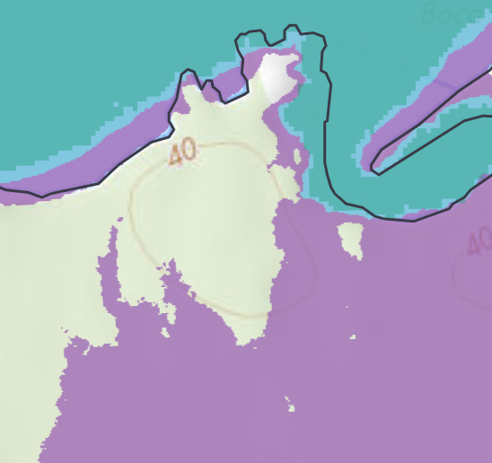
DRAFT Results
This small section of the study area is purposely missing context and legend because results have not been released to the public. It generally shows varying flood scenarios compared to one shoreline model in a non-populated area along the Washington State Coast. I was involved in generating the overall methodology and I defined the specific spatial modeling method. I generated each flood scenario using extensive python scripting and a variety of inputs which will be documented in the full report.