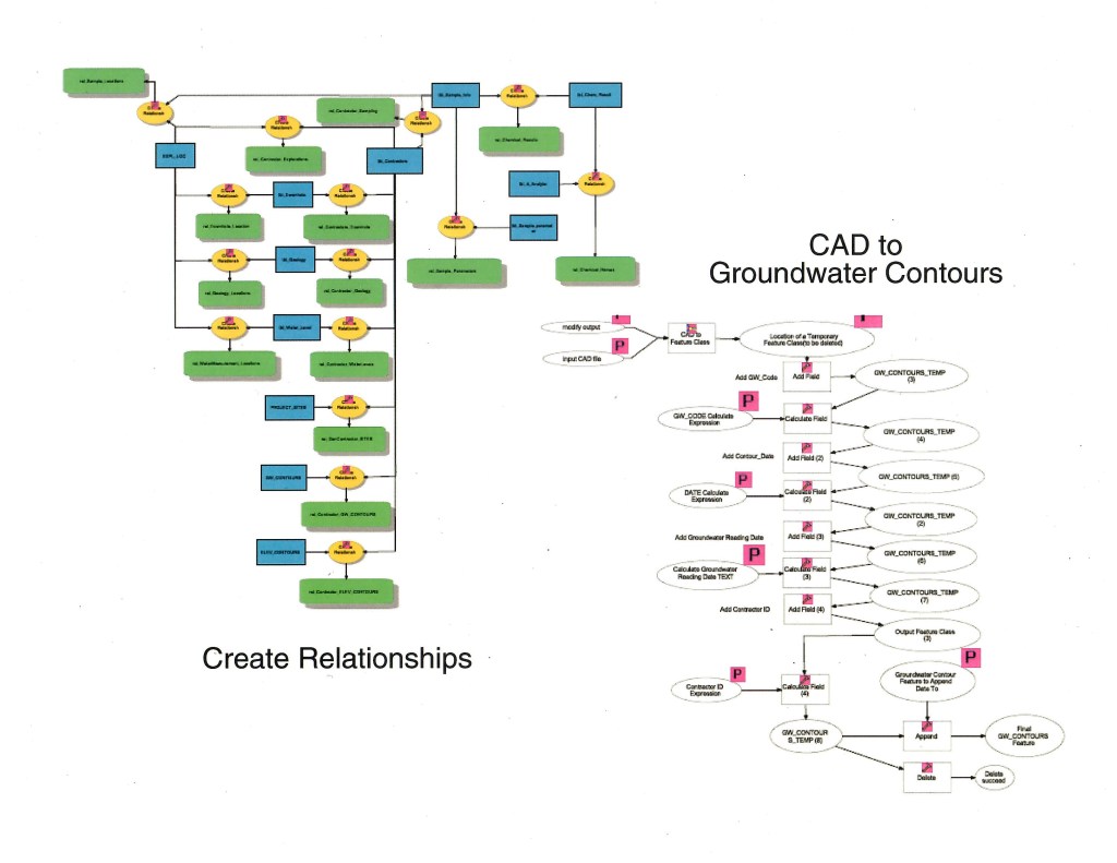
This is a graphic of a script I created using Model Builder in ArcGIS to create a groundwater contour feature class from imported CAD data. Assuming data management standards were adhered to with the CAD drawing, the script would take all the groundwater contours and create a feature class from them for optimum useability within the GIS. This took a multistep, time consuming process and made it happen reliably with the click of a button. This project was undertaken as a personal project.