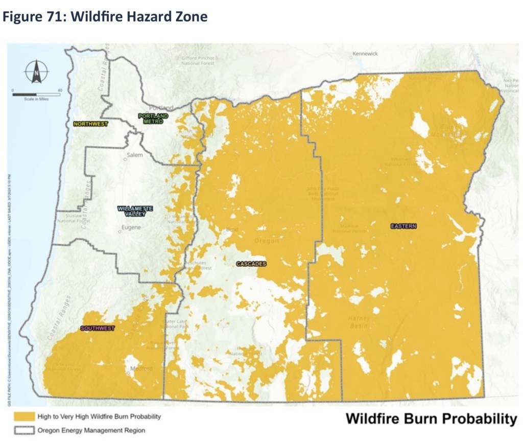
I conducted geospatial analysis focused on identifying the exposure of the liquid fuels network across the state of Oregon to ten identified climate variables. The network included pipelines, transportation routes, fueling stations, and many more critical components. The geo processing script I developed on this project is going to be very useful for adaptation to similar projects, and includes variable inputs for ease of use. Results were exported to tables for analysis by all project team members. Visual representations were customized to meet CNA specifications.
The plan, a large volume of work my many specialists from the Oregon Department of Energy (ODOE), CNA, and Haley & Aldrich, and others is included here.
The full report is here.
